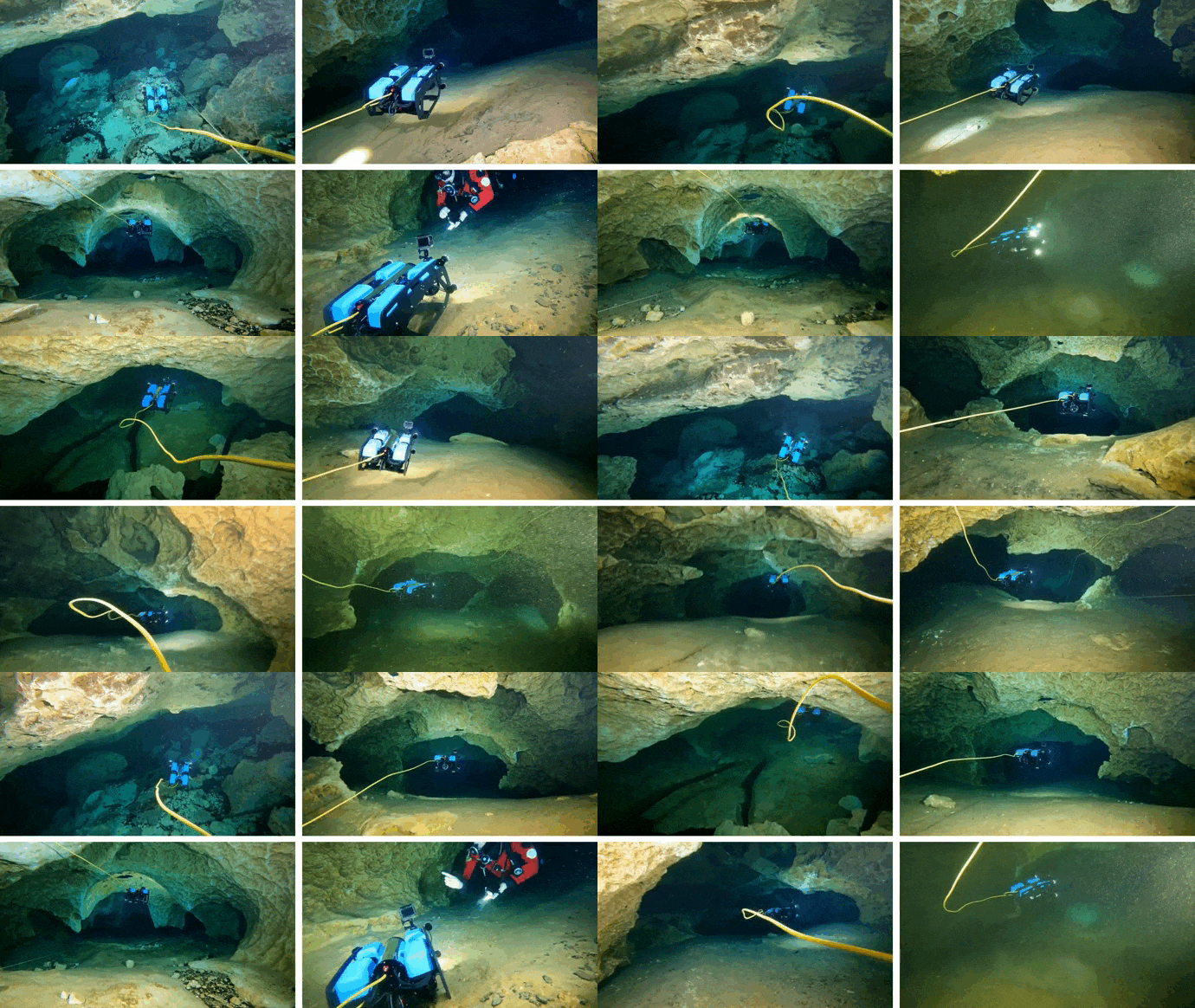
Underwater caves play a crucial role in groundwater flows in Karst topography, a type of landscape featuring sinkholes, sinking streams, caves, springs, and other characteristic features. Almost 25% of the earth's population relies on Karst's freshwater resources. In the United States, withdrawals from bedrock aquifers accounted for 23% of freshwater withdrawals. More water is withdrawn from the Florida aquifer than from all other carbonate aquifers combined, which is why monitoring the water quality and mapping those topographies are critically important. Our robots help human divers by collecting water quality data, topography mapping information, and navigating through the dangerous cave regions autonomously. This will help us explore the unexplored, map the unmapped and reveal archaeological mysteries. For these projects, we strongly collaborate with Dr. Ioannis Rekleitis (UDel) and Dr. Ramtin Zand (USC).

CaveSeg Project
In this project, we present CaveSeg the first visual learning pipeline for semantic segmentation and scene parsing for AUV navigation inside underwater caves. We address the problem of scarce annotated data by preparing a comprehensive dataset for semantic segmentation of underwater cave scenes. It contains pixel annotations for important navigation markers (e.g. caveline, arrows), obstacles (e.g. ground plane and overhead layers), scuba divers, and open areas for servoing. Moreover, we formulate a novel transformer-based model that is computationally light and offers near real-time execution in addition to achieving state-of-the-art performance. We explore the design choices and implications of semantic segmentation for visual servoing by AUVs inside underwater caves.
CL-ViT Project
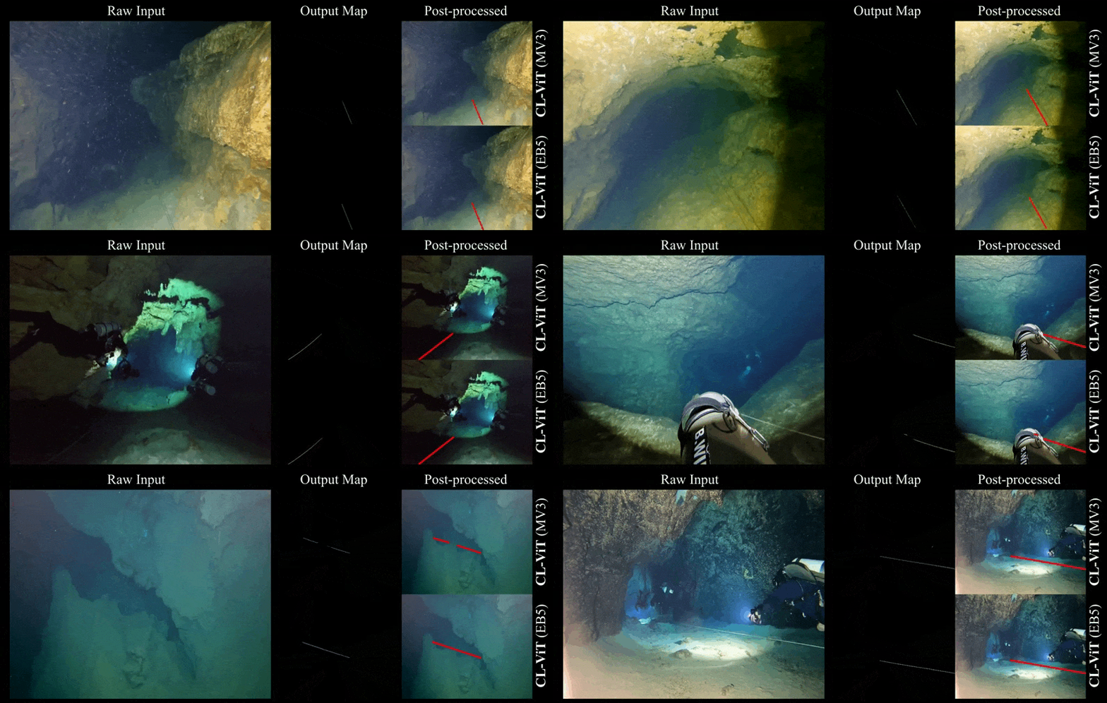
Caveline detection and following is paramount as robot navigation guidance in autonomous cave mapping missions. In the Caveline Project, we present a novel Vision Transformer (ViT)-based learning pipeline for fast caveline detection in images from underwater caves. We formulate a weakly supervised approach that facilitates a rapid model adaptation to data from new location with very few ground truth labels. We validate the utility and effectiveness of such weak supervision in three different cave locations: USA, Mexico, and Spain. Our proposed model, CL-ViT, balances the robustness-efficiency trade-off, and ensures good generalization performance while offering 10+ FPS on single-board Jetson TX2s.
Publications
- A. Gupta, A. Abdullah, X. Li, V. Ramesh, I. Rekleitis, and M. J. Islam. Demonstrating CavePI: Autonomous Exploration of Underwater Caves by Semantic Guidance. Robotics: Science and Systems (RSS), 2025, Los Angeles, CA, US. [project page code] (Acceptance Rate: 27%)
- M. Mohammadi, A. Abdullah, A. Juneja, I. Rekleitis, M. J. Islam, and R. Zand. Edge-Centric Real-Time Segmentation for Autonomous Underwater Cave Exploration. IEEE International Conference on Machine Learning and Applications (ICMLA), 2024, US.
- A. Abdullah, T. Barua, Z. Chen, R. Tibbetts, M. J. Islam, and I. Rekleitis. CaveSeg: Deep Semantic Segmentation and Scene Parsing for Autonomous Underwater Cave Exploration. IEEE International Conference on Robotics and Automation (ICRA), 2024, Yokohama, Japan. [project page]
- M. Mohammadi, S. Huang, T. Barua, I. Rekleitis, M. J. Islam, and R. Zand. Caveline Detection at the Edge for Autonomous Underwater Cave Exploration and Mapping. IEEE International Conference on Machine Learning and Applications (ICMLA), 2023, Jacksonville, US.
- B. Yu, R. Tibbetts, T. Barua, A. Morales, I. Rekleitis, and M. J. Islam. Weakly Supervised Caveline Detection For AUV Navigation Inside Underwater Caves. IEEE/RSJ International Conference on Intelligent Robots and Systems (IROS), 2023, Michigan, US. [project page]

